


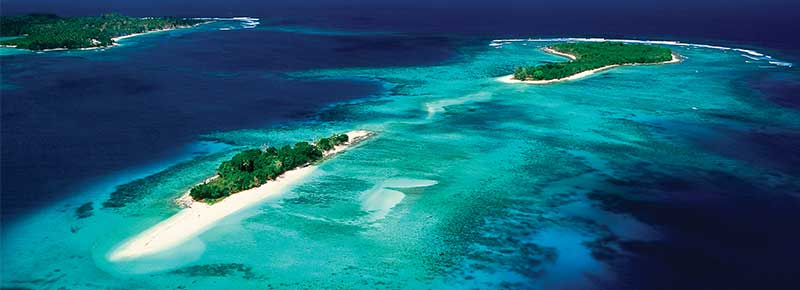
The Vanuatu Islands
Vanuatu Islands - Your Next Holiday Destination
Vanuatu is a worldwide favourite destination for travellers wanting a unique tropical destination that is relatively untouched by massive tourism trades. In fact, it is so beautiful that Vanuatu was ranked sixth on the Lonely Planet's list of the Top Ten Countries in the eagerly-awaited annual publication titled Best in Travel 2011. Lonely Planet's Asia-Pacific travel editor Shawn Low says that Vanuatu made the list for its unrivalled authentic cultural experiences. Come, explore and experience this wonderful island holidays destination!
Where is Vanuatu located?
The Republic of Vanuatu is an island nation located in the South Pacific Ocean. The Vanuatu archipelago is located around 1,750 km east of Australia, 500 km north-east of New Caledonia, west of Fiji and south of the Solomon Islands.
How long it takes to reach Vanuatu?
There are regular flights to Vanuatu from Brisbane, Sydney, Auckland, Noumea, Honiara and Fiji. Vanuatu is only a short distance from most eastern seaboard locations of Australia.
- Brisbane to Port Vila, Vanuatu flight time is 2.5 hours
- Sydney to Port Vila, Vanuatu flight time is 3.5 hours
- Auckland to Port Vila, Vanuatu flight time is 2+ hours

History & Customs of Vanuatu
Vanuatu was originally named New Hebrides during its colonial period. Many of the islands of Vanuatu have been inhabited for thousands of years, the oldest archaeological evidence being found dated all the way back to 2000 BC.
In 1605, the Portuguese explorer Pedro Fernández de Quirós became the first European to reach the islands, believing it to be part of Terra Australis. Europeans began settling the islands in the late 18th century, after British explorer James Cook visited the islands on his second voyage, and gave them the name New Hebrides.
In 1887, the islands began to be administered by a French-British naval commission. In 1906, the French and British agreed to an Anglo-French Condominium on the New Hebrides.
During World War II, the islands of Efate and Espiritu Santo were used as allied military bases. In the 1960s, the ni-Vanuatu people started to press for self-governance and later independence; full sovereignty was finally granted by both European nations on July 30, 1980. It joined the UN in 1981, and the Non-Aligned Movement in 1983.
Since 1994, Vanuatu has been divided into the six provinces of Malampa, Penama, Sanma, Shefa, Tafea and Torba. The main Islands within these provinces include Banks and Torres (Torba), Espiritu Santo (Sanma), Maewo and Pentecost (Penama), Malekula, Ambrym (Malampa), Epi, Efate (Shefa), Erromango, Tanna and Aneityum (Tafea).
Most of the islands are mountainous and of volcanic origin, and have a tropical or sub-tropical climate. The nation's largest towns are the capital Port Vila, which is situated on Efate, and Luganville, on Espiritu Santo.
The highest point in Vanuatu is Mount Tabwemasana, at 1879 m (6158 ft), on the island of Espiritu Santo. There are several active volcanoes in Vanuatu, including Yasur on the island of Tanna, one of the world's most accessible volcanoes, as well as several underwater ones.
Find out more about Vanuatu's Islands
- Epi Island
- Malekula Island
- Banks & Torres Island
- Ambrym Island
- Aneityum Island
- Pentecost Island
- Tanna Island
- Efate Island
- Espiritu Santo Island
Check out the Vanuatu Island Map for more information.
Air Vanuatu operates direct and indirect international flights to and from Vanuatu. Check out the Air Vanuatu Flight Schedule for more details.